My new year's resolution is to stop getting my hopes up whenever there's a storm coming. I have to worst luck when it comes to forecasting severe weather. for instance:


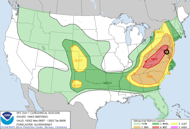
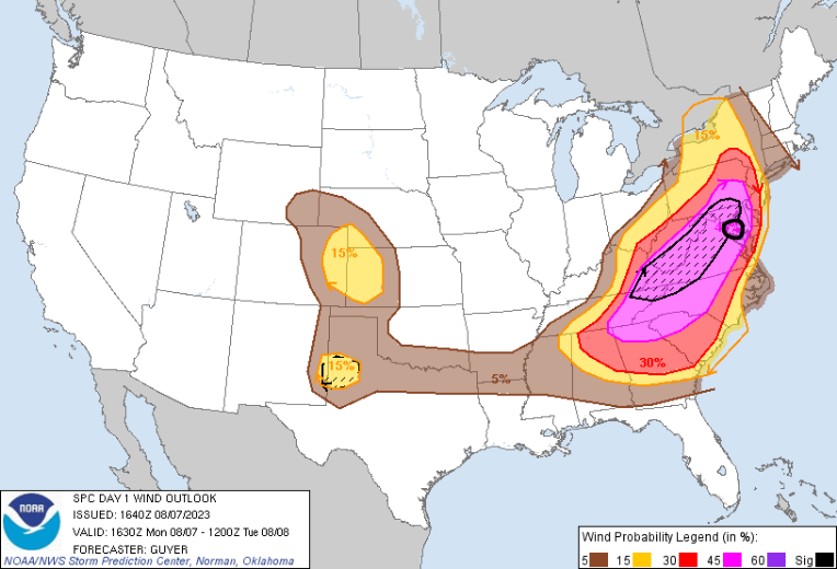
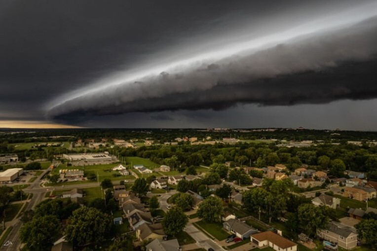
I live on the near the border of the moderate risk (red area) and near the edge of the hatched area, which means hurricane force wind gusts possible. Not only that, but the models were going crazy too. So naturally, it made the news, if i recall, some workplaces shut down, and summer school was cancelled for some too. My family starts calling me and asking me about it, and i say it's gonna get pretty bad. When the time comes, it BARELY EVEN RAINED, LET ALONE 75 MPH WIND GUSTS!!!! Safe to say i was done with severe weather for the year after that. A few weeks later, on a random day, we were under a slight risk for severe weather, and weren't expecting much on that day. I look outside, and the biggest, blackest shelf cloud i've ever seen is just staring me down. It looked kinda like this:

But still, i thought nothing of it, but 5 min later, the strongest storm i've ever seen in my life hit. Trees were breaking, people's cars were getting pummeled, it was scary. I didn't even check the weather that day.
Basically my new year's resolution is to stop caring about big storms, because they are almost never what they are hyped up to be.
Anyways, happy 2024!!
ChiralAnomaly
The SPC forecast is only meant to highlight a general area that is at risk of some type of severe weather. Severe storms are small scale features and the conditions can vary greatly from place to place. And forecast bust (where the actual outcome falls short of the indicated probabilities) is very possible too. It is not a chase forecast.
That's why storm chasers look at the actual radar, in addition to radar-assimilated hourly models like the HRRR. Severe weather potential is at least conditional on storm mode, mesoscale environment and individual storm interactions. No one can predict them accurately more than a day in advance.
Sometimes the SPC mentions the uncertainties and range of possible scenarios in their MD.
Reganati
It wasn't only the spc i looked at, i looked at the mesoanalysis, some sounding data near my area. I remember somewhere between 1600-2300 j/kg of cape, minimal capping, and there was a decent amount of shear. The main threat was a wind threat due to the linear outflow based storm mode. I remember a break in the line forming, and the line never recovered.