idk any floridians but whatever
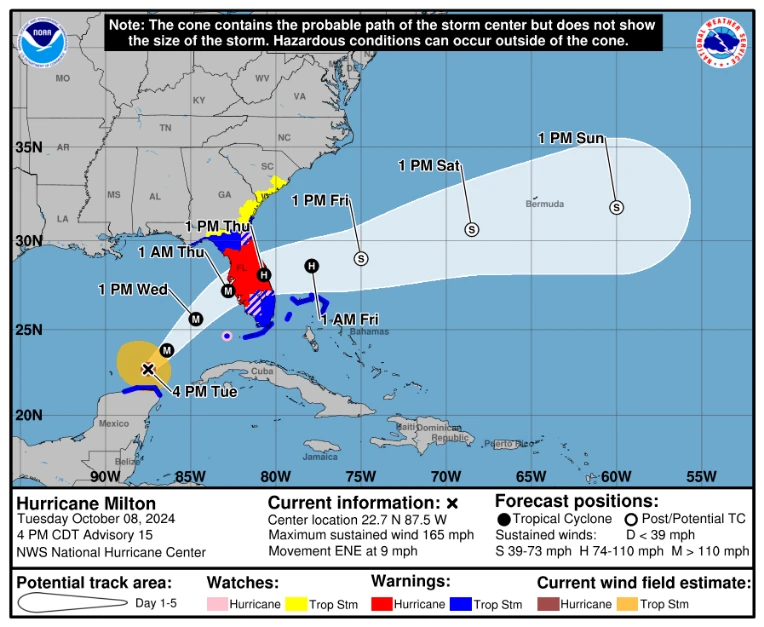
Hurricane Milton is shooting straight for florida, right now it is a cat 5, with winds of 165 mph. It reached a peak of 180 mph yesterday... It's not gonna make landfall as a cat 5 but regardless i wouldn't focus too much on the category because the surge is gonna be bad regardless.
Nearly the entirety of florida is under some type of tropical watch or warning, with a big ol' hurricane warning slicing the state in half. Remember: A hurricane/tropical storm watch means tropical storm/hurricane conditions are possible within the watch area, and a warning means tropical storm/hurricane conditions are expected somewhere within the warning area.

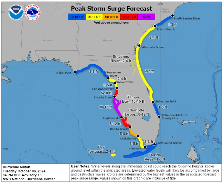
The surge with this storm is going to be terrible which is why i say it doesn't really matter the storm isn't a cat 5 at landfall... Also note there is going to be 3-5 ftt surge on the east coast of FL, because the storm could still be a hurricane/strong tropical storm when it exits florida.
ANOTHER note: not everywhere within say the tampa bay will see 12-15 ft surge, It means somewhere in that zone, 12-15 ft surge is possible, on top of high tide.
I'm not a meteorologist im just a dude if you want a forecast go to hurricanes.gov or nhc.noaa.gov

shiver me timbers

LakieGD
GET OUTTA HERE AS FAST AS YOU CAN!