


Moderate Risk of Severe Thunderstorms for the Lower/Mid Mississippi Valley, and into the Lower Ohio Valley
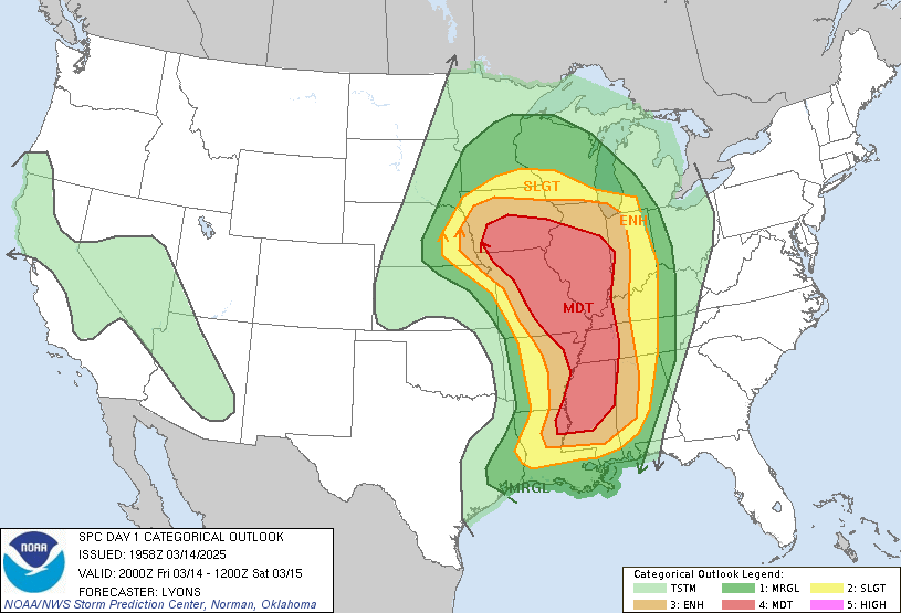
Big severe weather day ahead of us, Strong Tornadoes, 90+ mph winds and baseball sized hail are all possible tonight.
The storms are going to really start ramping up tonight, so if there is a tornado, you probably won't see it - If you get a warning on your phone then just get to shelter, i wouldn't test my luck today...
Here are some major cities in the path of this storm
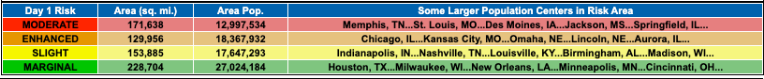
As you can see, millions are at risk of some bad weather tonight. Trust me, 90+ mph winds and baseball hail alone are nothing to be scoffed at.
Also eally concerned also about the nws staff shortages rn... mother nature picked like actually the worst time to have a fit :(
They all must be panicking rn...
Anyways that's it just wanted to share this along cuz i felt it was important.

*complimentary wintin picture for emotional support*